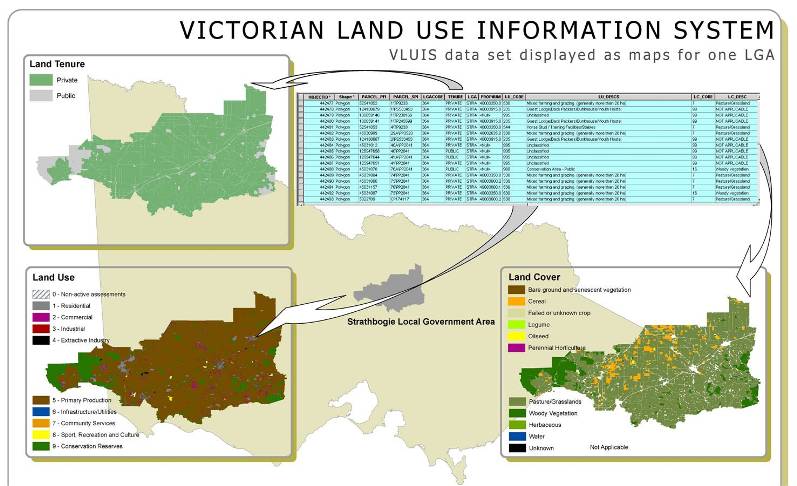
This web feature service is derived from the Victorian Land Use Information System (VLUIS) data set with all urban parcels removed. This layer has been created by the Spatial Information Sciences Group of the Agriculture Research Division in the former Department of Environment and Primary Industries Victoria. The method used to create VLUIS is significantly different to traditional methods used to create land use information and has been designed to create regular and consistent data over time. It covers the entire landmass of Victoria and the attributes separately describes the land tenure, land use and land cover for each cadastral parcel across the state. The land cover data is sourced (created) annually whilst the land tenure and land use data is available bi-annually.

Rural land use parcels for a local government area of Victoria
You can find more information on the VLUIS program for Victoria on Victorian Resources Online.
These maps are now available as a web feature service that can be integrated into desktop mapping and design clients such as ArcGIS, QGIS and Autocad. The following link describes how to access the Rural Parcel Web Feature Service.
Back to FarmBuild