
The Soil Area Calculation Service of FarmBuild's JavaScript library is available through the GITHUB Repository.
The Soil Area Calculation Service is a web service that returns the spatial intersection of the Farm Data Block (farm boundry and paddocks as defined by the user) with the soil survey information currently known for the Goulburn Murray Irrigation District (GMID). It can be integrated into new or existing platforms.
The Soils of the GMID dataset is also available as a web feature service. You can find more information on the soil surveys conducted in the GMID region on Victorian Resources Online.
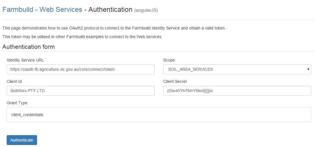
The Soil Area Calculation Service requires a valid OAuth2 protocol Token (authentication) in order to connect to the FarmBuild Identity service. The process to obtain successful authentication to the Soil Area Calculation Service is to:
- Register for Farmbuild.
- Keep your successful registration email in a safe place. It contains the "CLIENT ID" and the "CLIENT SECRET". These are required for application authentication.
- The FarmBuild authentication sample demonstrates the required data including the "CLIENT ID" and the "CLIENT SECRET" from registration process, to generate the client token.
The Soil Area Calculation Service sample includes the ability to:
- authenticate with OAuth using the client token
- load a farmdatablock.json file (can be generated from the FarmBuild Web Mapping component sample)
- return Farm Paddocks Area Intersection of GMID soil types
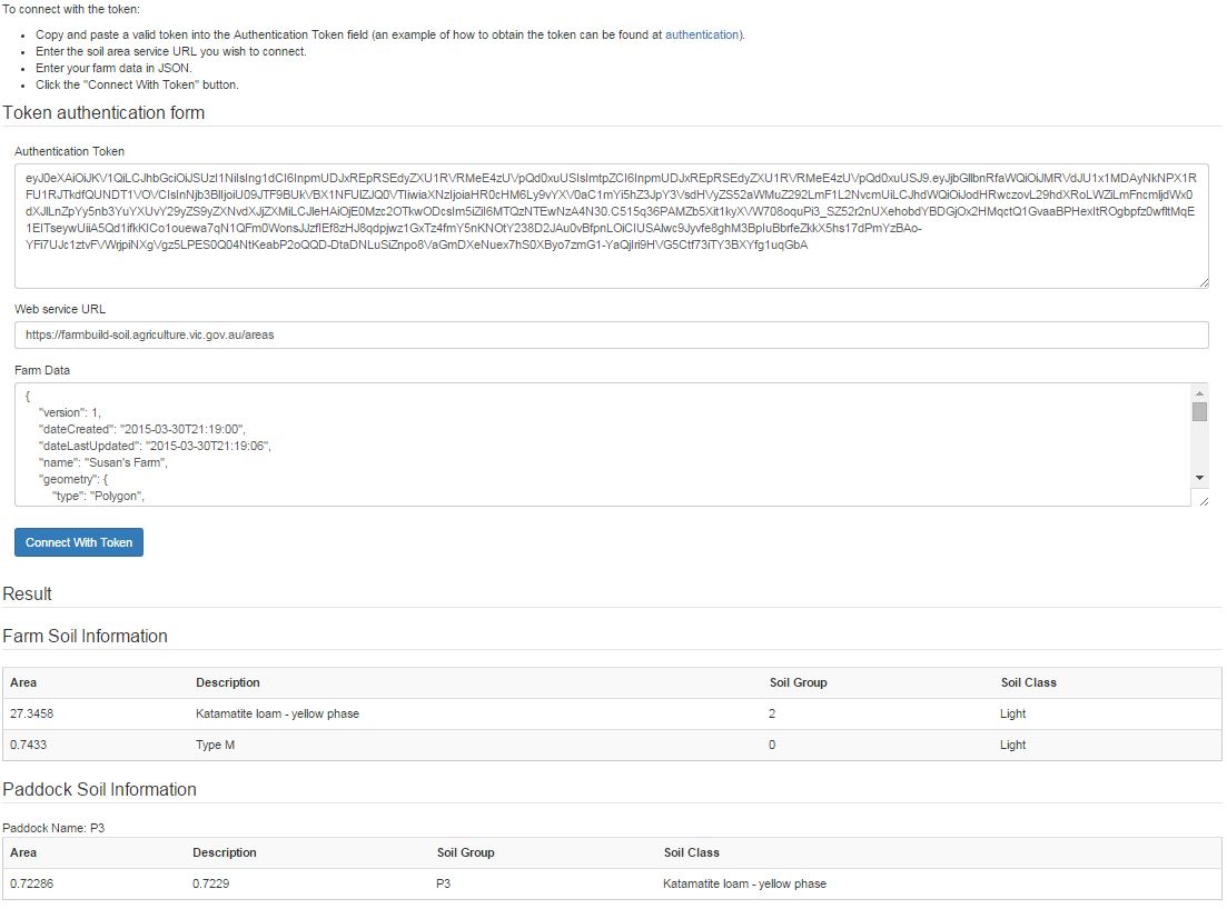
The Soil Area Calculation Service has been designed to write the soil description, and farm paddock data into a specified JSON structure called the Farm Data Block.
Through the JSON structure, the JSON exports are interoperable with the other FarmBuild components.
Back to FarmBuild