
Issue 2 - Summer 2017
Check it out
Map print service now available
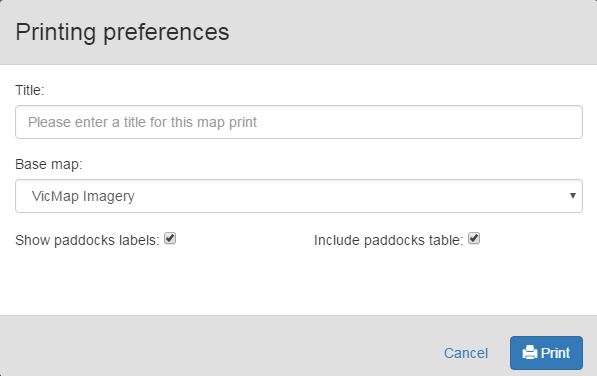
Image: Screenshot of the Map Print Service printing preferences that will return a PDF.
The map print service allows you to print your output from the FarmBuild mapping service. The service will return a PDF file via the Application Programming Interface (API). Now available on GitHub.
YouTube Videos
Web Mapping
This short 4 minute video demonstrates how to map a farm and paddocks using the FarmBuild web mapping tool and how to export to FarmData. The video then demonstrates how to reload into the mapping tool. Check out the ‘Mapping online demonstration’ at https://www.youtube.com/watch?v=FEKUifpJ1uk.
YouTube videos are also available on ‘Adding Layers to Mapping’, ‘Soil Area Service’, ‘Authentication’ and ‘Registration’ – Check them all out at: https://www.youtube.com/channel/UCWcc0Vtwk39g7wBPdSrUevA.
Coming Soon
How to download a version of FarmBuild to your desktop!
Winners are Grinners
In December, the FarmBuild team was presented with a DEDJTR Achievement Award by Secretary Richard Bolt for ‘facilitating the future of primary industries through the development and provision of the FarmBuild program’.
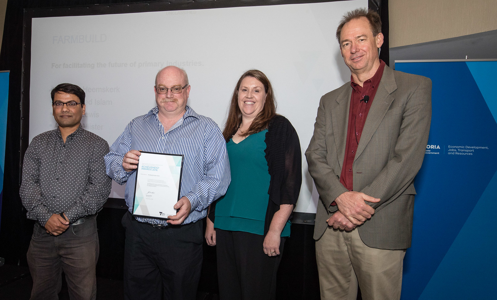
Image: Project Leader Andy McAllister (second from left) and team members Siraj Islam and Susan Robson accept
the DEDJTR Achievement Award from Secretary Richard Bolt (right).
FarmBuild Community of Developers
Need some assistance?
FARM RECORDS
Email: peter@farmrecords.com.au
www.farmrecords.com.au
Social: https://www.linkedin.com/in/peter-warren-3109b836
Mobile: 0418 416235
If you have experience developing an app or tool using FarmBuild and would like to offer your services to other FarmBuild users, please email Hayden.Lewis@ecodev.vic.gov.au.
Coming Soon
Animal Density Mapping
The animal density mapping function supports mapping and monitoring of the distribution of cows/animals across a farm according to paddock residence time.
This will provide a generic open source model for the distribution of cows/animals across a farm based on time spent within paddocks and management zones. The generic nature of this function will enable it to be integrated with a range of applications, including nutrient and grazing models.
Initial design work for this function was undertaken as part of joint work with the University of Missouri (USA).
How mapping benefits your business
Recently, the FarmBuild team received the following email from a new FarmBuild user. With permission to publish her words, Marian MacDonald of Jack River, Victoria discusses how important mapping programs are to her and her business.
Environmental Benefits
“Accurate mapping and the ability to store soil nutrient information allows farmers to help the environment by:
- Creating whole farm maps for environmental planning (we’ve done this, and are growing a network of wildlife corridors linking areas of significant habitat).
- Minimising the risk of nutrient leaching into waterways (we’ve done this by monitoring our soil test results and applying only the fertiliser necessary for productive pastures).
- Providing an accurate and reliable tool for fertiliser contractors (this means the correct amount of fertiliser is spread in the correct area rather than risking overspread into waterways).
- Providing an accurate and reliable tool for spraying contractors (so there is less risk of insecticides and herbicides being misapplied).”
Industry Risk Mitigation
“The mapping and nutrient tools will allow farmers to:
- Demonstrate best practice so there is less pressure for government to adopt the highly-regulated business models.
- Manage compliance, should it become necessary.”
More Efficient and Productive Farming
“We use mapping software for both routine farm tasks and planning. Examples of the value of such software includes:
- Lower fertiliser costs. Since we began soil testing every paddock annually, we have saved tens of thousands of dollars in fertiliser each year, while increasing the productivity of the pasture.
- Greater efficiency dealing with contractors. We can supply them with accurate maps.
- Better OHS. Maps are part of our induction process and also allow us to mark new hazards on maps for farm visitors and employees.
- Infrastructure planning. We are currently planning an extension to our small irrigation system, for example. The mapping software is essential to considering different scenarios and measuring distances. Critical to budgeting!
- New pasture planning and management. We turn to our mapping software every time we plan our fodder crops or pasture renovation, when ordering seed, communicating with sowing contractor and spraying for pests.
- Accessing grants. The mapping software allows us to illustrate the farm’s worthiness of NRM funding”.
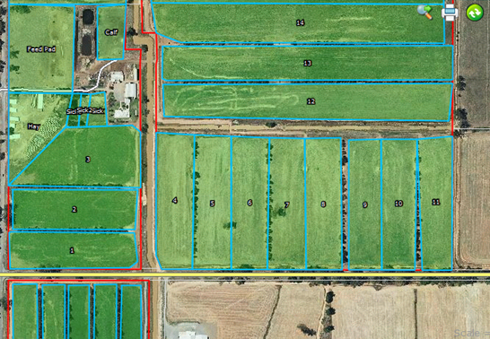
Image: An example farm map developed using FarmBuild.
Contact Us
Hayden Lewis - 03 5833 5997
Hayden.Lewis@ecodev.vic.gov.au
Register for FarmBuild
For more information on registering, please click here
TweetBack to FarmBuild